Progress on our cycle campaigner toolkit is steaming (pedalling?) ahead! Coding work began on Monday, and will continue solidly for the next few months.
The development of the toolkit has been possible thanks to our GeoVation award, which secured us £27,000 of funding. GeoVation is an Ordnance Survey initiative and forms part of the Ideas in Transit project with funding from the Technology Strategy Board and the Department for Transport.
We're pleased to introduce our developer team, Andy Allan, Andrew France, plus myself (Martin Lucas-Smith) from CycleStreets as project manager. Andy and Andrew will be working in it on solidly for the next few months so that a large amount of development can be done.
We're also approaching various designers and design companies for the work on the design and information architecture aspects of the project.
|
|
Andy Allan is a freelance developer and cartographer, specialising in all things related to OpenStreetMap. He is the creator of opencyclemap.org, the award-winning map for cyclists used by hundreds of websites and mobile applications, along with his recently developed transport map. He has helped develop the technology that powers OpenStreetMap including the online editor, Potlatch2, and is a member of the OSMF Operations Working Group. Andy lives and works in London but prefers cycling elsewhere. |
|
|
Andrew France is an experienced web application developer specialising in Ruby on Rails. A generalist by nature, he is just as happy designing intuitive front-end interfaces and writing JavaScript as he is constructing database schema. Andrew has worked on a variety of systems from charity sites to hazardous chemicals management and always looks forward to implementing new ideas. He is a keen traveller, cyclist, runner, and imbiber of ale. |
|
|
Martin Lucas-Smith is one of the two lead developers of CycleStreets. He'll be project-managing the toolkit project and getting involved in the Rails coding in the latter half of the project. For CycleStreets, Martin tends to deal with non-routing code and structure of the CycleStreets codebase; he also deals with most of the CycleStreets project management so that fellow developer Simon can concentrate on the complex routing work. Martin's actual job is as a Web Developer at the Department of Geography , University of Cambridge. |
Get involved in an exciting open source project!
The toolkit is to be developed as an open source project, with the code on Github. It will be written using the technologies of Ruby on Rails (v3.1), PostgreSQL, and jQuery.
Volunteers are needed to contribute to the code from the end of October. If you'd be interested, do let us know.
We're aiming to build a project team who will develop and look after the system from December onwards. By that stage, the grant-funded development work will mean that the system is already fully-featured and well coded so should be in a good state to add functionality to.
Timeline
We'll have:
- Screenshots of our 'alpha' available by 21st October.
- A beta available to a few campaign groups around Christmas. If your group would like to be a 'guinea-pig', do let us know! We'll start to open it up to more groups in the month following.
- General availability of the site after a period of bugfixing, scaling and iteration.
Stay tuned to this blog and our Twitter feed for updates.
We're also seeking an additional grant of around £10k to enable us to undertake solid coding on some of the more advanced features that groups have suggested, particularly do deal with more complex issues like cross-group sharing, which will increase the utility of the system considerably.
Designing the toolkit
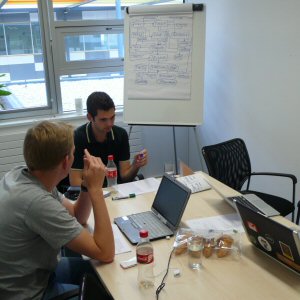
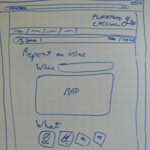
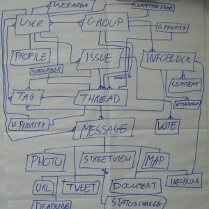
We held our first developer meetings this week to develop the specification further and do some wireframing:


