 |
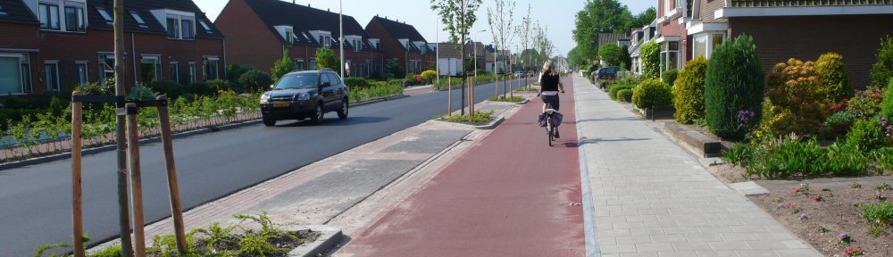
| Cycling in the Netherlands happens because of bike-friendly culture and excellent infrastructure. |
Let's face it - cycling conditions in the UK need to be improved massively. Cycle lanes that end unexpectedly, roads shared with lorries and traffic fumes, non-existent cycle parking. Any cyclist can give you a catalogue of problems that need tackling.
The end result is far fewer people cycling than there should be. Despite odd spots around the UK like Cambridge, Oxford, York which have a cycling culture, the outlook around the UK is not great.
Cycle campaign groups are key to changing this. These groups - large and small, national and local, are the people on the ground who work make cycling better. They're already enthused, so we need to give them as much support as possible.
 How can cycle campaigners deal with the deluge of problems on our streets?
As well as our journey planner, CycleStreets includes a Photomap (with so far around 26,000 photos), designed to allow cycle campaigners (like us) and the public pinpoint problems they experience. In short, it's a campaigning tool aimed to help campaigners do their job. However, it could be made a lot more useful and user-friendly than it currently is.
We plan to help solve the problems that every campaign group around the UK continually faces.
We want to build on the existing Photomap to provide cycle campaigners with the best possible tools to make their job much easier.
- Cyclists and the public need a better way to pinpoint problems like lack of cycle parking, desirable new cycle paths, better on-street conditions, etc.;
- Campaigners need tools to prioritise problems in their area and group related problems together;
- People need simpler means to collaborate by adding local knowledge and views about each problem;
- Cycle campaign groups need better tools to make the scale of the problem clearer;
- People who cycle through an area need to become aware of campaign work going on;
- The profile of local cycle campaign groups needs to be much higher and they can be helped get more members;
- Campaigners shouldn't have to reinvent the wheel but have access to great tools immediately;
- Campaign groups need to help Local Authorities listen and take up the problems;
- Local Authorities and funding bodies need a clearer idea of the scale of the problem so that money can be found;
- Campaigners need more direct access to related information such as collision statistics, to avoid having to search for it.
... all in the most user-friendly way possible.
How would it work, in brief?
- Cyclists would pinpoint problems (points/lines) on a map, e.g. lack of cycle parking, hostile roads, absence of needed route, poor quality cycling conditions, etc., with a photo if available
- (Mobile apps can also post to the database using the existing infrastructure to enable this.)
- Others can publicly comment on each submission and add local knowledge
- A 'heat map' of problem areas would start to develop, together with per-point indications of status of a problem
- Each location effectively becomes an entry in both the map and in a forum-style view
- Campaign group members would log in to their group's area of the website, and would have drag-and-drop -style tools to prioritise and discuss the locations. Locations could also be grouped together, e.g. so that multiple issues arising from one development are treated most effectively.
- Documents, e-mails and web references can be 'attached' to a particular issue so that all information relating to one issue is in one place.
- Cyclists in each area would also be encouraged to register and to 'draw on the map' their typical journeys (helped by the CycleStreets journey planner), so that they can then be alerted to issues and campaigns along those routes
- As an issue progresses in terms of external campaigning, it is updated and 'published' in various ways via the site
- Prioritised lists can be 'pushed out' to Local Authority contacts, or they can be invited to join the conversation
- When issues are finally resolved these would be marked as such, also publicising the work of the group concerned
- Where routes in the CycleStreets journey planner are planned that pass through improved areas, the work of the group would be publicised!
The whole system would need to be extremely user-friendly, so that it gets the widest possible usage and actively engages people without technical skills.
Our proposal
We are proposing to submit a bid to the GeoVation Challenge, the Ordnance Survey initiative which is running a funding competition, "How can we improve transport in Britain?".
We plan to bid for one of the six pots of £30,000 available to create an extremely user-friendly set of tools that would be available free-of-charge to every campaign group in the country, branded in an area-specific way and embeddable within campaign group websites.
Put simply, we want campaigners to be able to carry out their work much more effectively, to reduce the effort required, all the way from identifying problems to seeing them fixed. As members of Cambridge Cycling Campaign, we have ourselves long-needed tools like this, and we want to create a facility which will be enthusiastically taken up around the country.
 Here is our full draft proposal. We welcome ideas for enhancements.
Please support our bid
Please comment on the bid here.
Please let us know your comments - you can contact us or just leave a comment below.