Cycle campaign toolkit: introducing our developer team

GeoVation

Progress on our cycle campaigner toolkit is steaming (pedalling?) ahead! Coding work began on Monday, and will continue solidly for the next few months.

The development of the toolkit has been possible thanks to our GeoVation award, which secured us £27,000 of funding. GeoVation is an Ordnance Survey initiative and forms part of the Ideas in Transit project with funding from the Technology Strategy Board and the Department for Transport.

We're pleased to introduce our developer team, Andy Allan, Andrew France, plus myself (Martin Lucas-Smith) from CycleStreets as project manager. Andy and Andrew will be working in it on solidly for the next few months so that a large amount of development can be done.

We're also approaching various designers and design companies for the work on the design and information architecture aspects of the project.

Andy Allan is a freelance developer and cartographer, specialising in all things related to OpenStreetMap. He is the creator of opencyclemap.org, the award-winning map for cyclists used by hundreds of websites and mobile applications, along with his recently developed transport map. He has helped develop the technology that powers OpenStreetMap including the online editor, Potlatch2, and is a member of the OSMF Operations Working Group. Andy lives and works in London but prefers cycling elsewhere.

Andrew France is an experienced web application developer specialising in Ruby on Rails. A generalist by nature, he is just as happy designing intuitive front-end interfaces and writing JavaScript as he is constructing database schema. Andrew has worked on a variety of systems from charity sites to hazardous chemicals management and always looks forward to implementing new ideas. He is a keen traveller, cyclist, runner, and imbiber of ale.

Martin Lucas-Smith is one of the two lead developers of CycleStreets. He'll be project-managing the toolkit project and getting involved in the Rails coding in the latter half of the project. For CycleStreets, Martin tends to deal with non-routing code and structure of the CycleStreets codebase; he also deals with most of the CycleStreets project management so that fellow developer Simon can concentrate on the complex routing work. Martin's actual job is as a Web Developer at the Department of Geography , University of Cambridge.

Get involved in an exciting open source project!

The toolkit is to be developed as an open source project, with the code on Github. It will be written using the technologies of Ruby on Rails (v3.1), PostgreSQL, and jQuery.

Volunteers are needed to contribute to the code from the end of October. If you'd be interested, do let us know.

We're aiming to build a project team who will develop and look after the system from December onwards. By that stage, the grant-funded development work will mean that the system is already fully-featured and well coded so should be in a good state to add functionality to.

Timeline

We'll have:

  • Screenshots of our 'alpha' available by 21st October.
  • A beta available to a few campaign groups around Christmas. If your group would like to be a 'guinea-pig', do let us know! We'll start to open it up to more groups in the month following.
  • General availability of the site after a period of bugfixing, scaling and iteration.

Stay tuned to this blog and our Twitter feed for updates.

We're also seeking an additional grant of around £10k to enable us to undertake solid coding on some of the more advanced features that groups have suggested, particularly do deal with more complex issues like cross-group sharing, which will increase the utility of the system considerably.

Designing the toolkit

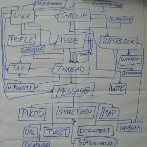
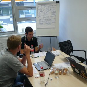
We held our first developer meetings this week to develop the specification further and do some wireframing:
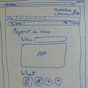


Cycle campaign toolkit – spec

We're pleased to publish an updated specification for the campaigner toolkit, following consultation with groups and including further changes.

There's been lots of useful feedback submitted by e-mail, twitter, blog replies, and in meetings we've had. These comments were turned into about ten pages of bullet-points (165 points!) for working into the spec.

Many of the points raised were useful points for clarification, or small new features, and a few raised issues relating to group structure. There were no problems raised with the substantive direction and nature of the toolkit.

The Description of the toolkit and what it will do is still available and has not needed to be updated. However, the full detailed functional specification has been updated and is below.

We were delighted to receive various positive comments which very much reflect our hopes for the system. For instance:

"One great advantage I can see is that it'll potentially help balance out the workload within our cycle campaign by allowing the latest status on any particular issue to always be seen on the system. Getting more campaign member involvement will also help with our committee's workload."

"I like the push/pull options of mail list and forum. Can't think of anything you've missed. I'm hopeful that this will encourage common issues to do with rules or conventions to float to the top and be tackled at source."

Things that have been updated or added in the spec, as a result of the consultation are:

  • Clarification of the idea of a 'Library' of best practice
  • Presence of tips to help best practice in campaigning
  • Specification of the polls and petitions components
  • Issues relating to federated/overlapping groups
  • Committee privacy basis
  • Notion of groups having democratically-agreed policy stances that members must adhere to
  • Clarifications about grouping and splitting of threads
  • Ability to involve elected Councillors rather than just officers
  • Tightening of a few areas regarding mail integration
  • Emphasis on outcomes rather than endless discussion
  • Notion of cross-member 'recommended campaign' topics
  • Daily digest
  • Removal of the notion of a compromise objective, which could undermine a group's negotiating position
  • Addition of avoidance of uploading very large volumes of documents, which could create costs
  • And various other minor changes

The latest version of the specification is available. It is now a living document that incorporates updates in the light of implementation as we move into the coding/design phase.

A draft Module structure (work in progress) which describes an implementation of the functional specification, is being finalised. This will form the basis of the developers' work.

We need a name for our campaigning toolkit!

Since we won £27,000 for the development of our campaigning toolkit we've been pondering what to call it.

The themes we want to capture in the name are:

  • The idea of a central place where cycle users around the UK can submit problems they encounter on the street network
  • A central place to facilitate campaigning
  • Cycling (!)
  • Collaborative
  • Well-informed campaigning
  • Constructive and forceful debate but without being adversarial
  • Improving our streets and routes
  • Keeping track of all the problems and being able to manage them effectively
  • The ability to say "I'll report it on the … website" and write "Go to … to report/fix a problem"
  • Name needs to be short and catchy - long names are harder to type in

Here are some initial ideas we've had, though not all are usable names - it was just a brainstorm. We're not really happy with any of them. Can you help suggest a catchy name? Leave a comment below or drop us a line.

  • Helping campaigners campaign …
  • BetterBiking
  • CycleStars
  • CityRevolution
  • CyclingSorted
  • CycleTrac
  • CycleTicks
  • Complain.com
  • Cyclocracy
  • Cyclington
  • HelpThem2HelpUs
  • CyclingUpTheAgenda
  • CycleTherapy
  • CycleTraction
  • CycleActive
  • CycleActivist
  • Cyclamity
  • CycleUnison
  • CyclingIntelligence
  • CycleLand
  • PeletonPeople
  • CyclingBestPractice
  • PracticalPeople
  • CycleMyths
  • CycleBugs
  • CycleLeague
  • CycleLeaders
  • RideLeader
  • BikePatch
  • BikeFettling
  • BikePatch
  • Agenda4Change
  • PathRoute
  • RidePatch
  • PatchNetwork
  • PathStreets
  • StreetPatch
  • StreetStrategy
  • Strategy4Streets
  • StreetFocus
  • RouteStrategy
  • RouteToCommute
  • RouteShare
  • StreetLever
  • CrowdedStreets
  • CrowdedOut
  • StreetCrowd
  • StreetVision
  • CycleTool
  • ToolForStreets
  • StreetsAhead
  • FeasibleAndDesirable
  • Note>Log>Act
  • StreetsShared
  • OnRampForCampaigners
  • Vent
  • CyclingSoldiers
  • CycleMission
  • CrowdsourcingCyclingIssues
  • CycleLinks
  • Collaborate

Cycle campaign toolkit – comments sought

As we announced recently, CycleStreets is one of the winners of the GeoVation contest, with our bid for a comprehensive online campaigning toolkit to assist cycle campaign groups around the UK.

The first phase of this project is finalising a specification for the toolkit. Here is the description of what it will do. This outlines what the toolkit will do, how people and groups will be able to use it. The full specification also has a prioritisation of these features.

We warmly welcome comments from groups around the UK on this draft, and will be publishing a further more finalised draft, incorporating comments received, in a week's time for our deadline of 24th July. Please do contact us to give us your views.

We've tried to include as many of the ideas we've received and come up with as possible. We hope the attached draft will give cycling groups an idea of how much the toolkit will assist their work.

We hope also its themes of bringing campaigners together and, where possible, involving Local Authority contacts will help usher in a collective spirit of work to improve cycling conditions around the UK.

Let us know your thoughts.

Older versions:

CycleStreets campaigner toolkit bid wins GeoVation contest!

We're pleased to announce that our bid, for a comprehensive online campaigning toolkit to assist cycle campaign groups around the UK, is a winner in the GeoVation contest!

It brings £27,000 for the development of a toolkit which, in the words of one supporter, should be "a hugely important step forward for all cycle campaigning groups".

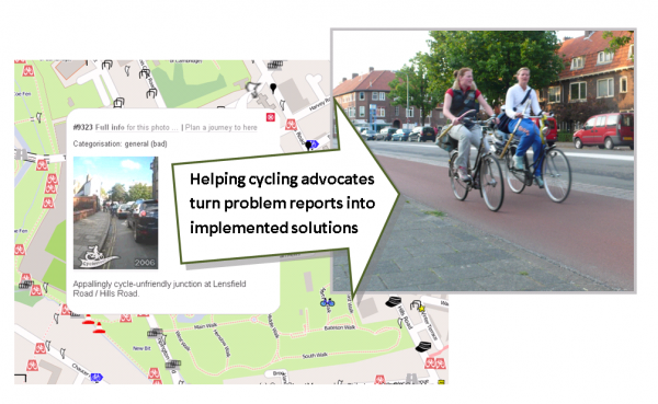
Turning problem reports into implemented solutions

Our bid was one of 155 ideas submitted to the GeoVation challenge, on the theme of "How can we improve transport in Britain?". Our bid was shortlisted, and we attended the GeoVation Camp in March to help develop the proposal amongst a total of 30 ideas invited. We were one of the final ten proposals, and took part in a Dragon's Den -style pitch on Wednesday.

We were delighted to be picked as one of the winners who share the £150k pot of funding.


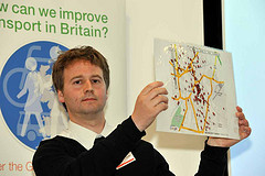
Photos by Ordnance Survey, licenced CC BY-NC 2.0

Martin Lucas-Smith, who presented the bid alongside CycleStreets' routemaster, Simon Nuttall, said:

"We were delighted to be picked by the Ordnance Survey's judges as one of the winners. The £27,000 of funding will enable us to get this much-needed project off the ground.

"As a member of one of the many local cycle campaign groups who will benefit, I'm all too aware of the large number of issues on the street network that need improvement, and the difficulty of managing this deluge of problems.

"The new system will help campaigners around the country convert these problem reports into prioritised, well-evidenced solution proposals. It should help them work more productively with local councils to see changes implemented."

We'd like to thank all the groups who provided quotes of support for our bid, including the CTC, Cyclenation, London Cycling Campaign, and a variety of groups around the country. We're working to provide you with a really great, useful and user-friendly system that will save a lot of time and effort.

Some of the things the new system will be able to do are:

  • Enable members of the public and campaigners easily to pinpoint where cycling is difficult
  • Help groups prioritise what to work on
  • Pull in planning application data automatically, so that potential issues needing attention are readily accessible
  • Automatically notify and involve people who cycle through an area - who therefore have an interest in seeing issues fixed
  • Make geographical data such as collision data and accessibility analysis easily available, to provide context
  • Enable simpler and more focussed discussion based on specific issues, groups of issues, or themes
  • Enable best practice to be 'pulled-in' to discussions, by providing off-the-shelf examples shared from elsewhere in the UK
  • Enable groups to include LA contacts in these discussions if they wish
  • Enable groups to assemble 'solution' resources so that problems can be resolved on the ground
  • Give groups a variety of ways of publishing their activity on their website easily.

GeoVation is run by the Ordnance Survey, and uses funding from the Technology Strategy Board and Ideas In Transit, and the Department for Transport. It runs challenges to address specific needs within communities, which may be satisfied in part through the use of geography.

We'll have more details soon about the next steps. As the plans develop, we'll be issuing calls for comments from groups in the cycling community, before we start with any coding.

We're delighted also that MySociety's strong bid for a mobile version of their forthcoming FixMyTransport was another winner - congratulations to them!

More support for our GeoVation bid coming in

As we prepare to face the judges at the Dragon's Den -style contest for GeoVation on May 4th, we're encouraged that more support is continuing to come in.

CPRE (The Campaign to Protect Rural England) work actively on transport matters amongst other issues around the UK.

They have added their support:

"The Campaign to Protect Rural England is delighted to be able to support the CycleStreets GeoVation Challenge bid. We have been working with local communities and parish councils to increase travel options in rural areas as part of our Transport Toolkit project, which was featured in the Department for Transport's Local Transport White Paper earlier this year. Through this work we have found there is a real need for new on-line collaboration tools to help improve conditions for cycling. We believe these innovative proposals would be a huge step forward not just for cycling campaign groups but for others engaged at the local level who seek to improve the range of sustainable travel choices."

- Ralph Smyth, Senior Transport Campaigner, CPRE

Also, the creator of the heavily-used OpenCycleMap map, Andy Allan, has written on his blog about "The Problem of Cycle Complaining" and supporting our bid.

He describes our bid as "a hugely important step forward for all cycle campaigning groups". He hits the nail on the head, recognising the same problems that we and other groups around the country have found, as this extract explains:

If a cycle group want to approach a council to convert one-way roads into two-way, they are unlikely to have the traffic simulations to show the five most useful changes. There’s just a huge gulf in tools and technologies available to each side, so when the only way things work is for one side to suggest and the other to accept/refuse, it’s easier to see where so much reactionary complaining comes from.

Enter the guys behind CycleStreets, with their “Helping campaigners campaign” proposal. You can read it for yourself, but in summary is a web-based tool to track, manage and develop solutions to infrastructure problems facing cyclists. While it’s not a panacea for everything I’ve discussed, I think it’s a hugely important step forward for all cycle campaigning groups. Their proposal has been short-listed for the GeoVation awards finals in two weeks’ time and I wish them the best of luck, the funding from that would really kick things off. If you want to show your support then go for it, through your blogs, twitter or however you see fit. Even if they don’t manage the grand prize I hope to see their proposals come to fruition in the near future, especially given their track record of getting things done. I hope to get the opportunity to help their ideas see the light of day – it will be an excellent tool to help turn cycle complaining into the results we want to see.

CPRE and Andy Allan of OpenCycleMap join other supporters of the bid:

  • Cyclenation, the national federation of cycle campaign groups
  • CTC, the national cyclists’ organisation
  • London Cycling Campaign
  • Richmond Cycling Campaign
  • Bristol
  • Pedals (Nottingham Cycling Campaign)
  • Dublin Cycling Campaign
  • Cambridge Cycling Campaign
  • Spokes – the Lothian Cycle Campaign
  • Spokes (East Kent Cycle Campaign)
  • Loughborough & District Cycle Users' Campaign
  • Push Bikes, the Birmingham Cycling Campaign
  • CycleSheffield

Read their quotes of support in section 10 our full bid document.

If you're free on 4th May, we'd love you to come to the GeoVation Showcase to support us (and vote for us for the additional Community Prize!). It's a daytime event on the south coast, so we're aware it may not be easy for people to come to, but do come should you happen to be free. There are a number of other interesting projects, so it will be a good chance to hear about them and mingle and network with other innovators.

Get your free ticket here: http://geovationshowcase2011.eventbrite.com/

Here's a great picture of many of the people whose ideas got through to the shortlisting stage of GeoVation:

GeoVation

Photo credit: GeoVation blog

Press release: CycleStreets’ cycling project to face Dragon’s Den -style contest

A Cambridge-based project to improve cycling around the Britain has reached the finals of a national funding contest, GeoVation, run by the Ordnance Survey. GeoVation aims to combine Geography and Innovation to help fund ideas which will help improve transport of various kinds.

The bid by Cambridge-based CycleStreets, who run the UK-wide cycle journey planner website, has reached the final 10 projects aiming to improve transport in Britain. Over 150 entries were initially submitted, and CycleStreets have succeeded in the initial shortlisting stage and a subsequent workshop event.

The 'Dragon's Den' -style event to select the winning projects will be held on 4th May at the Ordnance Survey's new eco-friendly headquarters in Southampton. This 'GeoVation Showcase' event will select around five winners, who will share a bounty of £150,000, to enable the projects to be developed.

CycleStreets' proposal is for a web-based system to improve the effectiveness of cycling advocacy groups around the UK. These groups aim to get more people on their bikes, by encouraging local councils to create safer and more convenient conditions for cycling. It is designed to help volunteers who care passionately about improving cycling to work together as effectively as possible.

CycleStreets' proposal has the backing of both of the national cycling campaign bodies and a range of groups around the UK, including Cambridge Cycling Campaign. For instance, CTC – the national cyclists' organisation said:

"A webtool for cyclists to help local councils spend their cycling budgets cost-effectively would be a wonderful 'big society' venture, that could yield huge benefits for our health and that of our streets, communities and the environment."

CycleStreets' idea will make use of a variety of information sources, including the Ordnance Survey's boundary and postcode data, collision and planning application information, and OpenStreetMap data.

Dr Chris Parker, GeoVation Co-ordinator at Ordnance Survey, said:

"There are huge and exciting opportunities for geography to be harnessed to help us all travel in a smarter, more sustainable way, as all our finalists have clearly demonstrated. We're looking forward to seeing the CycleStreets pitch and wish them the best of luck."

Notes for editors:

  1. Information about GeoVation, and the finalists – including CycleStreets' proposal – can be found online at http://www.geovation.org.uk/.
  2. Details of CycleStreets' bid, 'Helping Campaigners Campaign' is at http://www.cyclestreets.net/blog/2011/03/06/geovation-bid-shortlisted/
  3. For more details, contact CycleStreets
  4. CycleStreets is a not-for-profit company based in Cambridge, and was created as an off-shoot of Cambridge Cycling Campaign.
  5. CycleStreets runs the UK-wide Cycle journey planner and Photomap at www.cyclestreets.net , which has had over 640,000 journeys planned. Users can plan cycle-friendly routes from A-B, and will get three options – a quietest, fastest and balanced route option. The Photomap enables people to add photos of cycling-related problems and good practice to the map.
  6. A copy of the Ordnance Survey logo and the CycleStreets logo are available. A full-size version of the graphic above is also available.

Through to the GeoVation final!

On the way to the OSLast week we took part in the GeoVation Camp at the Ordnance Survey's splendid new HQ in Southampton. It was a fun, if exhausting, weekend.

The purpose of the weekend was for GeoVation to narrow down to a final shortlist the ideas that would go to the final.

GeoVation presentationOur proposal is called 'Helping Campaigners Campaign' (a more catchy title to be determined!), and is aimed at making the work of existing cycle campaign groups be as efficient and effective as possible.

Over the weekend, we, along with the other 20 groups through to this stage of the contest, developed their ideas and prepared a presentation to the judges as well as a 2-minute pecha kucha presentation.

We're pleased to say that we're into the final 10! We'll be attending the final pitching stage on May 4th, and are looking forward to it. If we are amongst the winning groups, this would result in funding of around £30,000 to implement the idea.

Discussing the proposals   Developing the proposals

Several other proposals that we really liked, such as MySociety's FixMyTransport for mobile and a mobile multi-modal journey planner (which we hope would use our routing!) were also through to the final, which is great news.

CycleStreets’ bid to GeoVation shortlisted

How can we improve transport in Britain?

We're pleased to announce that our GeoVation bid, 'Helping Campaigners Campaign' has been shortlisted from the 155 ideas submitted to GeoVation!

The proposal is for an extensive suite of tools that will really help cycling campaigners around the UK - people who are already enthused - to be more effective in their work. It will build on the basic reporting facility in our Photomap and its fleldgling categorisation system.

These groups – large and small, national and local, are the people on the ground who work make cycling better. They're already enthused, so we need to give them as much support as possible.

However, there's a way to go yet - firstly we are invited to develop the idea at the GeoVation Camp, 25 – 27 March. The best ideas, hopefully including ours(!) will then go forward to the final pitching session, the GeoVation Showcase, on May 4th.

Support for our bid

We're pleased to say that the bid now has the support of both of the national cycle campaigning organisations as well as a number of the most active local groups, including the biggest, London Cycling Campaign:

  • Cyclenation, the national federation of cycle campaign groups
  • CTC, the national cyclists’ organisation
  • Cambridge Cycling Campaign
  • London Cycling Campaign
  • Richmond Cycling Campaign
  • Bristol
  • Pedals (Nottingham Cycling Campaign)
  • Dublin Cycling Campaign
  • Spokes - the Lothian Cycle Campaign
  • Spokes (East Kent Cycle Campaign)
  • Loughborough & District Cycle Users' Campaign
  • Push Bikes, the Birmingham Cycling Campaign
  • CycleSheffield

all of whom have written quotes of support. Please let us know if you would like to add your group to the list.

How would it work, in brief?

  1. Cyclists would pinpoint problems (points/lines) on a map, e.g. lack of cycle parking, hostile roads, absence of needed route, poor quality cycling conditions, etc., with a photo if available. Planning applications could also appear automatically where the data is available.
  2. (Mobile apps can also post to the database using the existing infrastructure to enable this.)
  3. Others can publicly comment on each submission and add local knowledge. Examples of best practice elsewhere in the system can be pulled in (e.g. as example solutions).
  4. A 'heat map' of problem areas would start to develop, together with per-point indications of status of a problem
  5. Each location effectively becomes an entry in both the map and in a forum-style view
  6. Campaign group members would log in to their group's area of the website, and would have drag-and-drop -style tools to prioritise and discuss the locations. Locations could also be grouped together, e.g. so that multiple issues arising from one development are treated most effectively.
  7. Documents, e-mails and web references can be 'attached' to a particular issue so that all information relating to one issue is in one place.
  8. Cyclists in each area would also be encouraged to register and to 'draw on the map' their typical journeys (helped by the CycleStreets journey planner), so that they can then be alerted to issues and campaigns along those routes
  9. As an issue progresses in terms of external campaigning, it is updated and 'published' in various ways via the site
  10. Prioritised lists can be 'pushed out' to Local Authority contacts, or they can be invited to join the conversation
  11. When issues are finally resolved these would be marked as such, also publicising the work of the group concerned
  12. Where routes in the CycleStreets journey planner are planned that pass through improved areas, the work of the group would be publicised!

The whole system would need to be extremely user-friendly, so that it gets the widest possible usage and actively engages people without technical skills.